



Agricultural Data & AI Platform

Transform agricultural data into decision power.

Weather, Sentinel-2 satellite layers, AI plant health diagnostics, and smart irrigation models. Build enterprise agricultural technology with a single REST API.

Sentinel-2 MSI

Spectral Crop Health

Monitor parcel-level vegetation, canopy moisture stress, and chlorophyll activity from space with NDVI, NDMI, NDRE, and NDTI layers.

Resolution: 10m GSD 5-Day Revisit
Meteorology & ET₀

Parcel Weather & Spraying

Plan agronomic operations with frost risk, hourly wind profiles, relative humidity, and reference evapotranspiration.

Forecast: Hourly / 14 Days Frost Risk
Computer Vision

Photo-based AI Diagnosis

Scan leaf photos at macro level to detect disease, pest, and nutrient deficiency symptoms in seconds.

Model Confidence: %92+ Visual NLP
Decision Engine

Dynamic Water Prescription

Calculate precise net water dose and estimated runtime by uniting soil texture, crop phenology, and root-zone water deficit.

Metric: Net mm Dose ET₀-Based
16
Modular Ag-Tech Services
Weather, Satellite, AI & Irrigation
< 180ms
API Response Time
Edge CDN & Low Latency
%99.9
Uptime SLA Guarantee
High Availability
TLS 1.3
Enterprise Security
End-to-End Encrypted Communication
Enterprise Ecosystem & Trust

Our Ecosystem

We advance agricultural data and decision-support systems alongside leading institutions in banking, agricultural machinery, plant nutrition, food industry, and local governments.

Vakıfbank
VakıfBank Agricultural Banking
Denizbank
DenizBank Grower Ecosystem
İGSAŞ
İGSAŞ Plant Nutrition
Ziraat Bankası
Ziraat Bankası Agricultural Finance
Türk Traktör
TürkTraktör Precision Agriculture
Tat Gıda
Tat Contract Farming
İzmir Büyükşehir Belediyesi
İzmir Metropolitan Mun. Smart City & Agriculture
Vakıfbank
VakıfBank Agricultural Banking
Denizbank
DenizBank Grower Ecosystem
İGSAŞ
İGSAŞ Plant Nutrition
Ziraat Bankası
Ziraat Bankası Agricultural Finance
Türk Traktör
TürkTraktör Precision Agriculture
Tat Gıda
Tat Contract Farming
İzmir Büyükşehir Belediyesi
İzmir Metropolitan Mun. Smart City & Agriculture
Modular Service Architecture

The data and intelligence you need for agriculture, in a single API.

Empower your mobile and web applications with ready-to-use agricultural capabilities through the Andromedy Ag-Tech service catalog.

Weather GET /v1/weather/summary

Daily Weather Summary

Empower your growers to start the day knowing their fields.

Delivers an intuitive summary of daily weather conditions for the user coordinates or selected parcel. Combines temperature, rain, and atmospheric data to guide field decisions.

What It Delivers
  • Daily weather summary for the selected coordinates or parcel.
  • Unified presentation of temperature, rain probability, and atmospheric status.
  • Structured data schema ready for dashboard and parcel detail views.
Input: Coordinates / Parcel ID JSON REST
Weather GET /v1/weather/forecast

Hourly + Daily Weather Forecast

Plan field operations not just for today, but for days ahead.

Provides hourly and daily weather forecasts structured for agricultural logistics. Enables users to review intra-day trends as well as multi-day outlooks.

What It Delivers
  • Hourly and 7-14 day meteorological forecasts.
  • Wind speed/direction, humidity, cloudiness, and rain probabilities.
  • Cross-timeline comparisons for precise operational scheduling.
Input: Lat, Lon Hourly / Daily
Field Management POST /v1/fields

Field Information

Turn field onboarding into the launchpad for data-driven services.

Allows users to delineate parcel boundaries on map and aggregate production metadata. Presents parcel geometry, crop cultivar, planting/harvest dates, and soil/irrigation methods.

What It Delivers
  • Interactive map polygon boundaries and automated hectare area computation.
  • Field name, crop cultivar, planting, and expected harvest dates in one record.
  • Relational linkage of soil texture, irrigation system, and GIS coordinates.
GeoJSON / Polygon GIS Compliant
Field Management GET /v1/field/spraying

Spraying Suitability Window

Transform weather data into actionable crop spraying decision support.

Evaluates microclimate factors to highlight optimal spraying windows. Rather than merely listing raw numbers, it answers: 'When is it safe and effective to spray?'

What It Delivers
  • Spraying efficacy index based on wind speed, temperature, and precipitation.
  • Actionable suitable vs. high-risk operational time windows.
  • Decision support for crop protection and chemical application safety.
Input: Field ID Decision Support
Field Management GET /v1/field/irrigation

Irrigation Schedule

Convert irrigation planning into a clear calendar experience for growers.

Presents tailored parcel irrigation schedules in an intuitive timeline. Displays irrigation dates and required water volume together to help growers execute and monitor plans.

What It Delivers
  • Chronological calendar view of scheduled irrigation cycles.
  • Irrigation dates paired with net water dose (mm) requirements.
  • Real-time precipitation offset integrated directly into irrigation scheduling.
Input: Field ID, Crop Calendar Format
Satellite GET /v1/satellite/true-color

Satellite Imagery Layer

Assess field intelligence alongside real-world optical satellite imagery.

Enables remote field inspection via calibrated satellite imagery. Displays parcels and surrounding terrain on a map to interpret agronomic data in true spatial context.

What It Delivers
  • High-resolution satellite imagery inspection for agricultural acreage.
  • True geographical visualization of parcel boundaries and adjacent landscape.
  • Map overlay supporting remote agronomic audits and field scouting.
Sentinel-2 RGB Tile / WMS Service
Satellite GET /v1/satellite/ndvi

NDVI Vegetation Growth Map

Inspect crop canopy development on spatial satellite heatmaps.

The NDVI layer visually evaluates vegetation vigor and biomass across the field. Highlights spatial variation and vegetative divergence across parcels.

What It Delivers
  • NDVI vegetation index raster layer derived from multi-spectral satellite data.
  • Spatial visualization of intra-field canopy vigor and density contrasts.
  • Early detection of underperforming zones for targeted ground scouting.
Spectral Index (NDVI) 10m Pixel Resolution
Satellite GET /v1/satellite/ndmi

NDMI Moisture Layer

Analyze moisture variations across your acreage with satellite indices.

Delivers satellite canopy moisture metrics on field maps. Visualizes moisture gradients across parcel zones to guide irrigation and scouting visits.

What It Delivers
  • NDMI canopy moisture raster map derived from NIR and SWIR bands.
  • Spatial evaluation of moisture stress patterns across field sections.
  • Remote moisture auditing prior to irrigation cycles and field audits.
Moisture Index (NDMI) Water Stress Tracking
Satellite GET /v1/satellite/ndre

Nitrogen Map (NDRE)

Examine the crop nitrogen status across all zones of your field.

Visualizes satellite indicators for crop nitrogen uptake and chlorophyll status. Maps vegetation vigor across parcel zones to support fertilization planning.

What It Delivers
  • Nitrogen index computed from Sentinel-2 Red-Edge spectral bands.
  • Visual multi-zone inspection of foliar chlorophyll gradients.
  • Decision support for variable-rate nitrogen fertilization prescriptions.
NDRE Red-Edge Chlorophyll Saturation
Satellite GET /v1/satellite/radar-rain

Radar / Live Precipitation

Visualize live precipitation dynamics in relation to your fields.

Tracks real-time and incoming precipitation fronts on map. Enables users to observe storm paths and rain clouds directly over their acreage.

What It Delivers
  • Real-time tracking of active storm fronts and approaching rain cells.
  • Precipitation intensity radar overlay across fields and local basins.
  • Critical evaluations for harvest and spraying feasibility before operations.
Doppler Radar Network Real-Time Layer
Data Turkey Only
GET /v1/data/news

Agricultural News

Integrate agricultural industry developments directly into your app.

Streams curated agribusiness news and agricultural updates directly into your digital portal, keeping producers informed within their daily workflow.

Regional Coverage: This service only provides data for Turkey; international data is not available.
What It Delivers
  • Real-time curated news feed covering agriculture, commodities, and policies.
  • Plug-and-play article list and detail view schema for your app.
  • Engaging editorial content tailored for farmers, agronomists, and agribusinesses.
RSS / API Integration Curated Content
Data Turkey Only
GET /v1/data/fuel-prices

Fuel Prices

Deliver real-time pricing data for critical agricultural inputs.

Provides transparent fuel price tracking for diesel and motor fuels. Enables producers to monitor local fuel costs alongside machinery and harvest budgeting.

Regional Coverage: This service only provides data for Turkey; international data is not available.
What It Delivers
  • Current regional diesel and motor fuel price tables by province/district.
  • Automated cost input for tillage, harvesting, and machinery logistics.
  • Granular data for operational fuel consumption and seasonal expenditure planning.
Province / District Filter Daily Update
Data Turkey Only
GET /v1/data/grants

Support & Grants

Simplify subsidy and grant discovery for agricultural producers.

Surfaces available agricultural subsidies, rural development funds, and grant calls. Displays eligibility requirements, calendar deadlines, and descriptions in an organized catalogue.

Regional Coverage: This service only provides data for Turkey; international data is not available.
What It Delivers
  • Categorized directory of active agricultural grants and incentive funds.
  • Application calendars, qualifying criteria, and program summaries.
  • Clear guidance to navigate farm financing and government incentive schemes.
Ministry & Rural Development Compliant Active Submissions
Notifications POST /v1/notifications

Agricultural Notifications

Surface critical field alerts immediately to your users.

Delivers real-time agronomic alerts driven by microclimate, field conditions, or pest risks, turning static data into proactive grower engagement.

What It Delivers
  • Real-time notifications for weather risks, sensor thresholds, and crop events.
  • Critical alerts for severe frost, extreme precipitation, and storm hazards.
  • Omnichannel delivery via Push Notifications, Webhooks, or SMS pipelines.
Webhook / Push Event-Driven
Artificial Intelligence POST /v1/ai/ask

Agricultural Q&A / AI

Transform agronomic knowledge into an interactive Q&A experience.

Adds an AI-driven agronomic conversational assistant to your app. Users can ask questions in natural language and receive grounded agronomic answers.

What It Delivers
  • Natural language conversational interface for crop and agronomic queries.
  • AI responses grounded in certified agricultural science and local practices.
  • Embedded conversational AI assistant running within your digital ecosystem.
Agronomic LLM Natural Language
Artificial Intelligence POST /v1/ai/plant-vision

Plant Vision AI

Turn field observations into instant computer vision diagnoses.

Enables users to upload plant foliage photos for instant AI visual diagnosis. Brings macro pest, disease, and deficiency screening directly into your mobile app.

What It Delivers
  • One-click leaf and crop photo upload workflow for instant inference.
  • Deep learning visual evaluation classifying pathogens, pests, and symptoms.
  • Seamless presentation of diagnostic results, severity, and guidance in-app.
Computer Vision Decision Support
Enterprise SLA & Security Standards
99.9% Uptime guarantee, <180ms median latency, and TLS 1.3 end-to-end encryption across all endpoints.
Developer Architecture

Built for developers.

Easily integrate Agromedy into your existing applications with standard REST APIs and structured data models.

  • Standard JSON REST API & Webhook Infrastructure
  • Secure, scoped authentication via Bearer Token
  • Enterprise SLA, high availability, and low latency
REST API Example
GET /api/v1/weather?lat=38.4237&lon=27.1428 Authorization: Bearer YOUR_API_TOKEN Accept: application/json // Response: 200 OK { "temperature": 24.3, "humidity": 62, "rainProbability": 15 }
Live Preview Sandbox Demo

API Playground

Select different endpoints and interactively experience simulated requests and responses.

Agromedy API Sandbox Demo Simulation
Service Endpoints 16 Services
GET /v1/weather/summary
Request Snippet
// İstek kodu hazırlanıyor...
Bearer YOUR_API_TOKEN
Server Response 200 OK
142ms
{ ... }
Format: application/json Encoding: utf-8
API Simulation & Response Schema Notice Demo Sandbox

Request parameters, data models, and return values shown in the API Playground are simulated and may vary based on active data providers, regional sensor calibrations, and version releases. For live production integration, enterprise SLA terms, and final contracts, please contact our team.

Smart Water & Irrigation Management

Base irrigation decisions on real data.

Digitize irrigation scheduling by jointly evaluating weather, soil, and crop data.

Parcel:
Decision Model: ET₀ & Soil Sensor
Parcel Area 12.4 ha Corn (Zea mays)
Soil Moisture
%38 / 50% threshold
Today's Irrigation Requirement 18.6 mm Net water dose
Estimated Irrigation Runtime 2h 15m 1 Cycle per Day
System Decision: Critical Threshold — Irrigation Recommended
ET₀: 4.8 mm/day • Soil Class: Clay-Loam • Water Savings: 28%
Visual AI Plant Diagnostics

Generate agricultural insight from a single photo.

Support agricultural decision-making by analyzing crop photos with computer vision AI.

Sample:
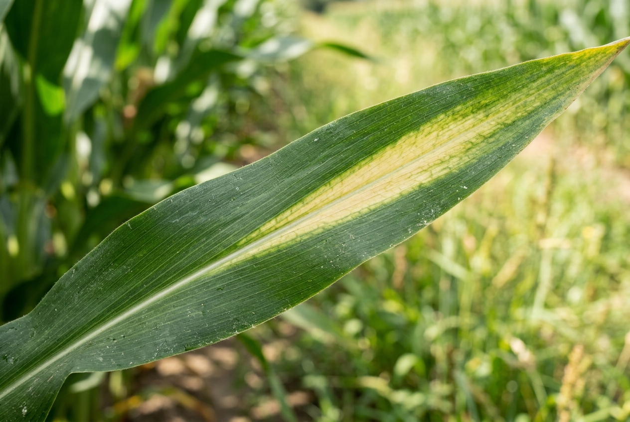
Mısır yaprağı görsel analizi
AI VISION • MACRO FPS: 30
ROI #1
RGB SENSOR 4K MACRO
RGB Spectrum • Macro Visual Diagnosis
AI Decision Support Output

Corn (Zea mays)

Mild Stress Symptom
Observed Symptoms:
  • V-shaped intra-leaf chlorosis (yellowing along midrib)
  • Localized nutrient deficiency symptom on lower leaves
Model Confidence Level: %88
Note: These results provide visual decision support. Certified agronomist review is advised for definitive diagnosis and chemical prescriptions.
Remote Sensing Service

Monitor fields not only from the ground, but from space.

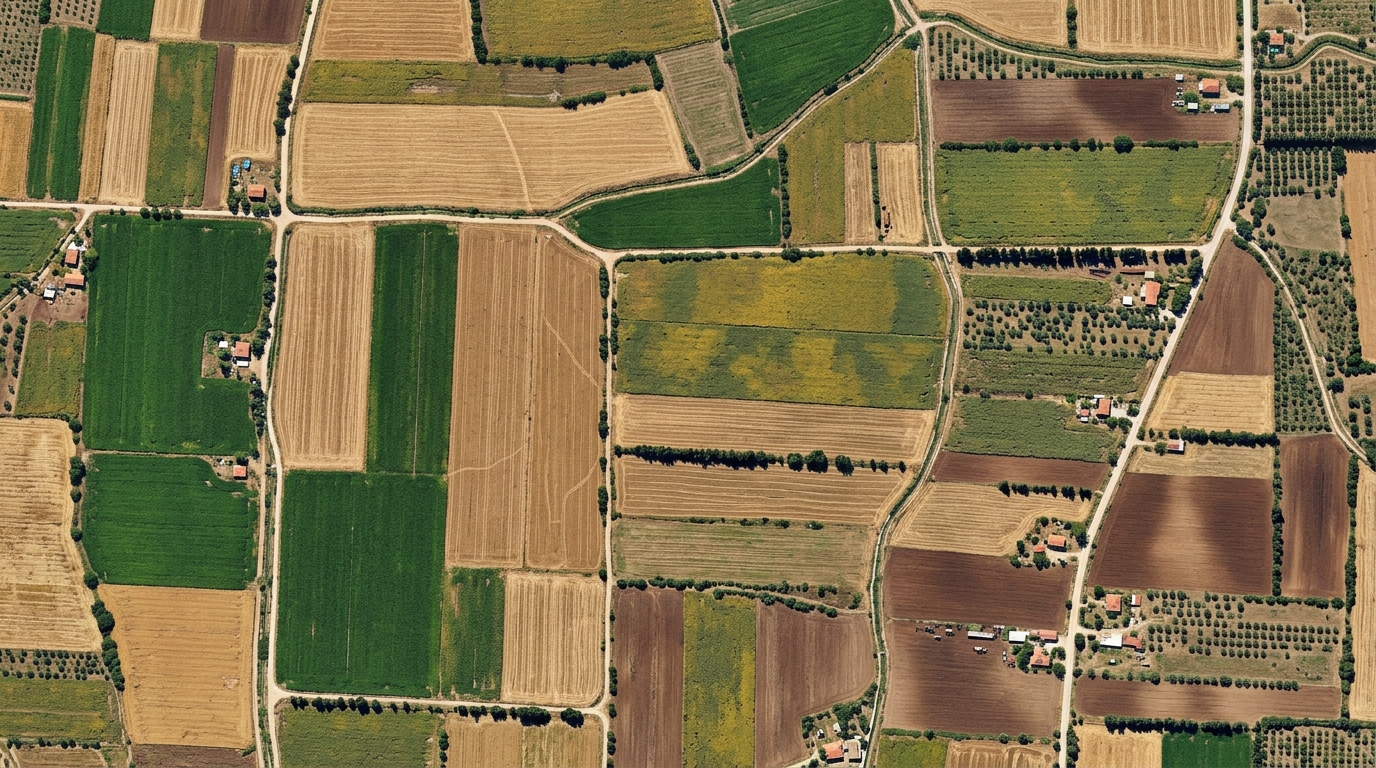
Parcel-based vegetation, moisture, and ground cover tracking with Sentinel-2 spectral data.

Index:
Revisit:
Sentinel-2 Gerçek Renkli Uydu Fotoğrafı
Sentinel-2A • 10m GSD
NDVI • Vegetation Layer
Z-1 Z-2 Z-3
Area: 14.8 ha
N ↑
Index Value High Vegetation
0.72 (0.00 – 1.00 scale)

(NIR - Red) / (NIR + Red) • Plant biomass, chlorophyll, and overall vegetation vigor.

Low (0.0) Optimum High (1.0)
Temporal Comparison
Previous 0.64
Current 0.72
Change +12.5%
Cloud Cover: %1.2 Resolution: 10m x 10m

* Sentinel-2 spectral layers are simulated in alignment with Copernicus program standards.

Integration Scenarios

What can you build with Agromedy?

Built for teams creating agricultural digital products and services across multiple industries.

01

Digital Farming Applications

Add agricultural data and AI capabilities to mobile and web apps for farmers.

02

Fertilizer & Ag-Tech Industry

Enhance your digital products with weather, satellite, soil, and AI decision support.

03

Agricultural IoT

Combine field sensor streams with Agromedy APIs to build comprehensive precision decision systems.

04

Agri-Finance & Banking

Embed agricultural data intelligence into digital products evaluating agricultural loan portfolios.

05

Enterprise Agri-Platforms

Power existing ERP, CRM, or grower platforms with integrated agricultural data and AI services.

Nature Accounting & Biodiversity

Data-driven agriculture begins with a sustainable ecosystem.

The future of agricultural production depends not only on yield optimization, but on ecosystem conservation, soil health, and making biodiversity measurable.

Biological Sensors

Pollinator & Bee Ecosystem

Bees and pollinators are nature's smart sensors. With IoT smart hives and acoustic AI models, floral health, pollen activity, and environmental stress indicators are monitored 24/7.

IoT Smart Hive Acoustic AI
Spectral Analytics

Natural Accounting via Satellite

Biomass growth, soil moisture balance, and carbon sequestration potential are verified as time series through Sentinel-2 NDVI, NDRE, and NDTI spectral bands.

Sentinel-2 L2A Time Series
Corporate Standards

ESG & GRI 304 Reporting

Field biodiversity and satellite data are synthesized into auditable, investor-grade sustainability reports compliant with GRI 304, CDP, and TNFD standards.

GRI 304 & CDP ESG Compliant
Andromedy Ecosystem Solution

Transform your corporate land into a thriving, measurable ecosystem.

Turn your biodiversity commitments into verifiable scientific data using Andromedy's IoT beehive technology, field biodiversity audits, and satellite telemetry.

Contact

Contact Us for Your Project

Contact us to integrate data services into your agricultural application, build an enterprise digital product, or deploy custom biodiversity and ecosystem measurement systems.

Address

R&D & Innovation Center

Open in Maps

EGE TECHNO PARK, Erzene Mah. Ankara Cad. No: 172/67
35030 Bornova, İzmir, Turkey

Technology Development Zone
< 24h Response
Email info@andromedy.com

API integration and enterprise collaboration.

Social Media

Corporate Network & Digital Ecosystem

Enterprise Privacy & Security: All communications and data requests are secured under KVKK compliance and enterprise NDA confidentiality.

Send Us a Message Today

Outline your requirements, and our engineering team will respond within 24 hours.